size: 730848
sha1: cf855643796ee7b4bc53e4ac158a21c01434cbca
sha256: 73f399ad77a994b34cadab10aaeabc86cfe4f289d45271f2efa42f2c3ed47cbc
sha256 base64: c/OZrXeplLNMrasQquq8hs/k8onUUnHy76QvLD7UfLw=

size: 651947
sha1: 02a4ace6f0515192974acb64d307dcb04254413f
sha256: 12ebdf872f372436a3a021d2d8d7cceaddad357231d60886caa32109afe94143
sha256 base64: Euvfhy83JDajoCHS2NfM6t2tNXIx1giGyqMhCa/pQUM=


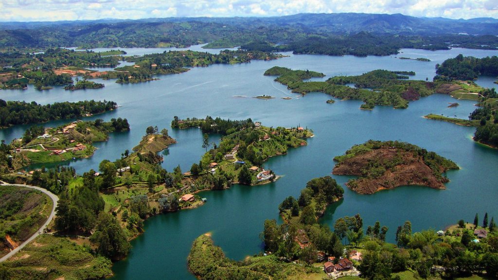
Here is the official location of the land masses in the photo.
Embalse Peñol-Guatapé,
Guatapé,
Antioquia Department,
Colombia.
The entire photo above is of the man-made lake created by the Guatapé Dam.
The body of water is named “Embalse Peñol-Guatapé” (Peñol-Guatapé Reservoir).
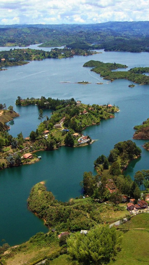
Look at the center of the photo, which becomes the main focal point in the second tall narrow image version below it.
This specific land jutting into the lake area is “Cabañas La Valentina”.
The vantage point in the photo makes the Rock of Guatapé El Peñol located at the bottom right of the above photo.
On the Google map of the Rock of Guatapé El Peñol, the irregular shaped landmass where Cabañas La Valentina sits, is to the left of the large rock.
Note: the “Rock of Guatapé El Peñol” is not in the photos above.
The word “Department”, for lack of a better explanation is like a Region or State. I tried to get information on the administrative divisions of Columbia to understand the political hierarchy of a “Department”, but it was poorly explained on the Internet. Suffice to say, “Antioquia” is a “Department” of Columbia.